
NRI CASI Grassland & Shrubland
by Center for Survey Statistics & Methodology, ISU
🗂️ Productivity
Features NRI CASI Grassland & Shrubland
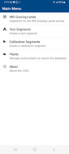
This is the Computer Assisted Survey Instrument (CASI) used to collect natural resources survey data consistent with the established protocols for the NRI Grazing Lands On-Site survey.These protocols measure the status and condition of land, soil, and related resources for rangeland, grassland, and shrubland.This software primarily is used by NRCS data collection teams and contractors to record observations at statistically chosen sample sites on non-federal lands in 49 states and BLM managed lands in 13 western states.
Similar surveys employing the same protocols can also make use of this software.This software was developed by the Iowa State University (ISU) Center for Survey Statistics and Methodology (CSSM) through a cooperative agreement with NRCS to support the NRI survey.Supported surveys are the United States Department of Agriculture (USDA) Natural Resources Conservation Service (NRCS) National Resources Inventory (NRI) Grazing Lands On-Site survey and the identical Department of the Interior (DOI) Bureau of Land Management (BLM) Landscape Monitoring Framework (LMF) survey.
This Android version of the software replaces the previous Windows Mobile version.
Smart Home
Control and monitor your home with smart features.
24/7 Support
Our dedicated support team is always ready to help you.
See the NRI CASI Grassland & Shrubland in Action
Get the App Today
Available for Android 8.0 and above